
Country Canada Established 1869 Population 52 (2011) | County Charlotte County Time zone AST (UTC-4) Province New Brunswick | |
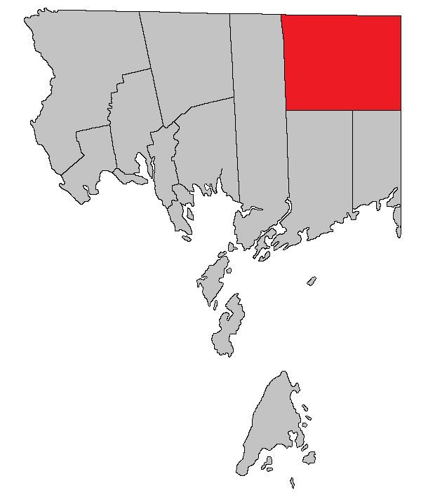 | ||
Clarendon is a Canadian parish in Charlotte County, New Brunswick.
Contents
- Map of Clarendon NB Canada
- History
- Delineation
- Governance
- Communities
- Bodies of water Islands
- Access Routes
- References
Map of Clarendon, NB, Canada
History
Clarendon Parish was established in 1869: named for George Frederick Villiers, 4th Earl of Clarendon, (1800-1870) and Foreign Secretary of England from 1853-1858 and from 1868-1870.
Delineation
Clarendon Parish is defined in the Territorial Division Act as:
West by Saint George Parish; north and east by the County lines, and south by a line run true west from the most southern angle of Queens County to the eastern boundary of Saint George Parish.
Governance
The entire parish forms the local service district of the parish of Clarendon, established 1975 to assess for fire protection. Recreational and sports facilities was added to the assessment in 2008.
Communities
Parish population total does not include incorporated municipalities (in bold).
Bodies of water & Islands
This is a list of rivers, lakes, streams, creeks, marshes and Islands that are at least partially in this parish
Access Routes
Highways and numbered routes that run through the parish, including external routes that start or finish at the parish limits: