
Time zone CST (UTC-6) Elevation 352 m Zip code 50524 Local time Monday 7:16 AM | Incorporated 1882 FIPS code 19-13485 Area 132 ha Population 142 (2013) Area code 515 | |
 | ||
Weather 13°C, Wind S at 31 km/h, 77% Humidity | ||
Clare is a city in Webster County, Iowa, United States. The population was 146 at the 2010 census. Clare was settled around 1882 by immigrants from Clare County Ireland. Clare is also home to a United States post office on W Front St.
Contents
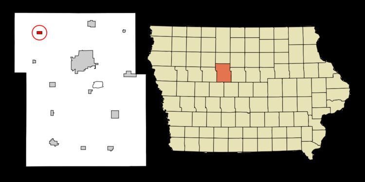
Map of Clare, IA 50524, USA
Geography
Clare is located at 42°35′16″N 94°20′37″W (42.587838, -94.343526).
According to the United States Census Bureau, the city has a total area of 0.51 square miles (1.32 km2), all of it land.
2010 census
As of the census of 2010, there were 146 people, 65 households, and 41 families residing in the city. The population density was 286.3 inhabitants per square mile (110.5/km2). There were 74 housing units at an average density of 145.1 per square mile (56.0/km2). The racial makeup of the city was 97.3% White, 2.1% African American, and 0.7% from other races. Hispanic or Latino of any race were 1.4% of the population.
There were 65 households of which 21.5% had children under the age of 18 living with them, 53.8% were married couples living together, 7.7% had a female householder with no husband present, 1.5% had a male householder with no wife present, and 36.9% were non-families. 30.8% of all households were made up of individuals and 15.4% had someone living alone who was 65 years of age or older. The average household size was 2.25 and the average family size was 2.80.
The median age in the city was 42.5 years. 19.2% of residents were under the age of 18; 9% were between the ages of 18 and 24; 23.2% were from 25 to 44; 30% were from 45 to 64; and 18.5% were 65 years of age or older. The gender makeup of the city was 53.4% male and 46.6% female.
2000 census
As of the census of 2000, there were 190 people, 79 households, and 50 families residing in the city. The population density was 374.4 people per square mile (143.8/km²). There were 79 housing units at an average density of 155.7 per square mile (59.8/km²). The racial makeup of the city was 98.42% White, 0.53% Native American, and 1.05% from two or more races.
There were 79 households out of which 29.1% had children under the age of 18 living with them, 50.6% were married couples living together, 3.8% had a female householder with no husband present, and 36.7% were non-families. 29.1% of all households were made up of individuals and 15.2% had someone living alone who was 65 years of age or older. The average household size was 2.41 and the average family size was 3.00.
In the city, the population was spread out with 25.3% under the age of 18, 8.9% from 18 to 24, 23.7% from 25 to 44, 25.3% from 45 to 64, and 16.8% who were 65 years of age or older. The median age was 41 years. For every 100 females there were 106.5 males. For every 100 females age 18 and over, there were 108.8 males.
The median income for a household in the city was $24,500, and the median income for a family was $40,000. Males had a median income of $31,875 versus $20,833 for females. The per capita income for the city was $13,838. None of the families and 6.0% of the population were living below the poverty line.