
Country Canada Community Etobicoke-York Local time Monday 5:53 AM | City Toronto Established 1849 (Subdivision) Province Ontario | |
 | ||
Changed Municipality 1998 Toronto from Etobicoke Weather 0°C, Wind E at 13 km/h, 67% Humidity Restaurants Pizza Hub, Wok Of Asia, Crave Grill House, Desi Spice, Caribbean Lyme | ||
Clairville is a neighbourhood and former village in the city of Toronto, Ontario, Canada. It is located in the northwest corner of Toronto, in the former city of Etobicoke. Today Clairville is almost wholly industrial/commercial.
Contents
Map of Clairville, Toronto, ON, Canada
History
The town of Clairville was established in 1850 at the intersection of Albion Road and Steeles. It was built on a land owned by Jean du Petit Pont de la Haye, a French teacher at Upper Canada College. He developed the community on his estate which he named after his daughter Claire. A private street was built diagonally across northern Etobicoke as a shortcut to Albion Township (now part of Brampton), with a toll at Clairville. The street was originally named Clairville but was also called the Albion Road (the current name for this street).
Re-development
Clairville largely disappeared after a dam was built on the West Branch of the Humber creating the Lake Clairville reservoir. In the 1970s Highway 427 was built north along the western edge of the neighbourhood and in the 1990s Highway 407 was built just to the north. This combined with the existing rail lines and proximity to Pearson Airport to make the area prime industrial land. Today all residential homes have disappeared in the Toronto section of Clairville and replaced with warehouses and factories.
Clairville was divided between municipalities, the portion west of Indian Road and Highway 427 is today in Brampton. Unlike in Toronto, Claireville, Brampton largely consists of new residential subdivisions north of Queen Street, Indian Line Campground and the Clairville Conservation Area in the south end.
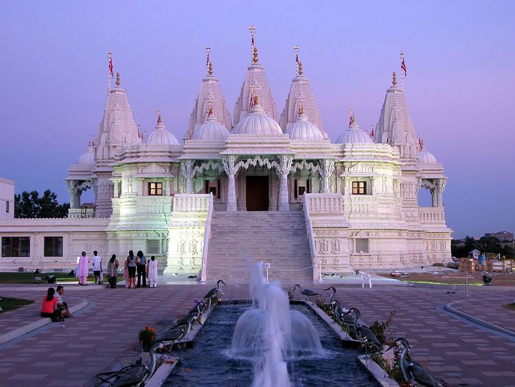
The area is close to the large south Asian communities of Brampton and Rexdale. The accessible area with large cheap lots has become home to several Hindu temples, most notably the BAPS Shri Swaminarayan Mandir Toronto.