
Progression Gunnison—Colorado Mouth Gunnison River | Source East Fork Cimarron River Country United States of America | |
 | ||
Main source Confluence of East Fork and Middle Fork
9,022 ft (2,750 m) River mouth Confluence with Gunnison River
6,755 ft (2,059 m) Bridges D & RG Narrow Gauge Trestle | ||
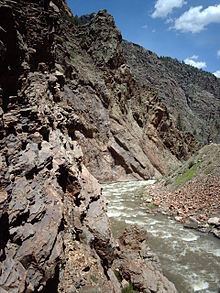
The Cimarron River is a 22.0-mile-long (35.4 km) tributary that joins the Gunnison River in Curecanti National Recreation Area near Cimarron, Colorado. The river's source is the confluence of two forks near Silver Jack Reservoir in the Uncompahgre National Forest.
Map of Cimarron River, Colorado, USA
A Denver & Rio Grande Western narrow gauge trestle is located near the confluence of the Cimarron and the Gunnison.
References
Cimarron River (Gunnison River) Wikipedia(Text) CC BY-SA