
River system Bucaná River | Length 9.5 km | |
 | ||
Main source Barrio Montes Llanos1,170 feet (360 m) River mouth Rio Portugues98 feet (30 m) Progression Montes LlanosPortugues Tributaries Left:Quebrada del Pastillo | ||
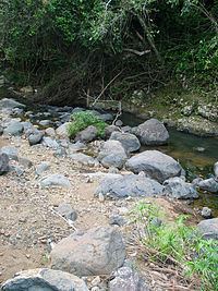
Chiquito River (Spanish: Río Chiquito) is a river in the municipality of Ponce, Puerto Rico. This river feeds into Río Portugues in the sector called Parras. It has its origin in the mountains west of Montes Llanos. Chiquito River is fed by Quebrada del Pastillo. This river is one of the 14 rivers in the municipality of Ponce.
Contents
Map of R%C3%ADo Chiquito, Ponce, Puerto Rico
Origin
Chiquito River has its origin in barrio Montes Llanos at an altitude of 390 meters (1,170 feet). It forms in the area north of Camino Paseo del Río and west of Camino Paseo Panorámico II, in south central Montes Llanos, about half kilometer west of PR-505, and approximately 1 mile (1.6 kilometers) north of the northern terminus of PR-504.
Course
Chiquito River runs from south central barrio Montes Llanos into north central barrio Portugues dividing barrio Portugues lengthwise from north to south into essentially two equal halves. It crosses several times the east-to-west Camino La Cuchilla Road as it continues southward. After this, the river is found next to the western edge of PR-588, also known as Camino Río Chiquito, until PR-588 comes to its southern terminus where it meets PR-504. From this point onward Río Chiquito runs southward along the western edge of PR-504 for approximately 600 meters until it crosses the PR-504. Running southward along the eastern edge of PR-504 for about one kilometer, Río Chiquito crosses PR-504 again to join Río Portugues some 300 meters after this point, where it ends. This southern terminus for the river occurs 250 feet north of PR-10, 250 feet east of PR-503, and 250 feet west of PR-504. At its mouth Chiquito River has an elevation of 98 feet.