
Country Vietnam Capital Đồng Mỏ Area 703 km² Local time Saturday 11:17 PM | Region Northeast Time zone UTC + 7 (UTC+7) Province Lang Son Province | |
 | ||
Weather 20°C, Wind S at 0 km/h, 87% Humidity | ||
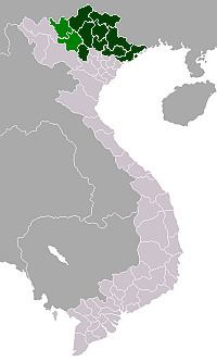
Chi Lăng is a rural district of Lạng Sơn Province in the Northeastern region of Vietnam.
Map of Chi L%C4%83ng District, L%E1%BA%A1ng S%C6%A1n, Vietnam
As of 2003, the district had a population of 77,910. The district covers an area of 703 km². The district capital lies at Đồng Mỏ.
The Chi Lang pass in this district was the site of many battles between feudal Vietnam and northern armies. Ly Thuong Kiet, Tran Hung Dao and Le Loi were among the army leaders that won battles in the district. Nowadays, many streets and places across Vietnam are named after the Chi Lang pass, most notably the Chi Lang Stadium in Da Nang.
References
Chi Lăng District Wikipedia(Text) CC BY-SA