
Population 7,421 (2011 census) Sovereign state United Kingdom Dialling code 01782 | OS grid reference SJ832494 Post town Newcastle, Staffs Local time Saturday 12:28 PM | |
 | ||
Weather 9°C, Wind S at 21 km/h, 67% Humidity District Borough of Newcastle-under-Lyme | ||
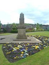
Chesterton ( /ˈtʃɛstətən/) is a small, former mining village, located in the Borough of Newcastle-under-Lyme, Staffordshire, England. It sits near the market town of Newcastle-under-Lyme.
Contents
Map of Chesterton, Newcastle, UK
Chesterton is the second largest individual ward in the Borough of Newcastle-under-Lyme, of which Kidsgrove is the largest. In the 2011 census, Chesterton's population stood at 7,421.
History
Chesterton was a parish in the Wolstanton Rural District from 1894 to 1904. Following that, it became part of the Wolstanton United Urban District until 1932, when it was added to the Borough of Newcastle-under-Lyme. The main employer in Chesterton was Holditch Colliery. The colliery employed 1,500 men and mined ironstone in addition to coal. Despite heavy investment in the 1960s and 1970s the colliery closed down in 1988, just three years after the end of the year-long miners' strike. Many of the miners transferred to nearby Silverdale Colliery, which itself closed down on Christmas Eve 1998. The current site of Holditch Colliery is now a large business park with warehouses and was where a large Vodafone call centre stood until the building was vacated in November 2009.
Education
It has a small secondary school, Chesterton Community Sports College, that has just under 500 pupils, and four primary schools, Churchfields Primary, Chesterton Primary, Crackley Bank Primary and St.Chad's Primary.
Religion
Chesterton is home to seven churches, Chesterton Holy Trinity Church Elim Pentecostal Church, St Johns the Evangelist Church Holy Trinity C of E Church Chesterton URC and St Chads Church Chesterton Salvation Army is both a church and a thriving Community Centre