
NECTA New Haven Time zone EST (UTC-5) Zip code 06412 Local time Saturday 7:10 AM | Incorporated 1836 Elevation 110 m Population 3,832 (2005) | |
 | ||
Region Connecticut River Estuary Weather -9°C, Wind NW at 10 km/h, 45% Humidity | ||
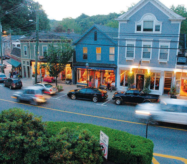
Chester is a town in Middlesex County, Connecticut, United States. The population was 3,743 at the 2000 census. The town center is also defined by the U.S. Census Bureau as a census-designated place (CDP).
Contents
- Map of Chester CT USA
- History
- Geography
- Demographics
- CDP
- Education
- Media
- Points of interest
- On the National Registered Historic Places
- Industry
- Air
- Ground
- Notable people
- References
Map of Chester, CT, USA
History
The Wangunks, a river tribe of Native Americans, occupied the land called Pattaconk prior to English settlement of the area in 1692. The town was formed from the northern quarter of Saybrook and incorporated in 1836. Back in 1769, Jonathan Warner was granted permission to operate a ferry across the Connecticut River that became the Chester-Hadlyme Ferry, the second-oldest continuously operating ferry service in Connecticut. Its location is currently a state historical landmark.
Geography
According to the United States Census Bureau, the town has a total area of 16.8 square miles (44 km2), of which, 16.0 square miles (41 km2) of it is land and 0.8 square miles (2.1 km2) of it (4.75%) is water. The CDP has a total area of 2.1 square miles (5.4 km2) of which 1.46% is water.
Demographics
As of the census of 2000, there were 3,743 people, 1,510 households, and 1,005 families residing in the town. The population density was 233.5 people per square mile (90.2/km²). There were 1,613 housing units at an average density of 100.6 per square mile (38.9/km²). The racial makeup of the town was 96.79% White, 0.85% African American, 0.35% Native American, 0.83% Asian, 0.05% Pacific Islander, 0.24% from other races, and 0.88% from two or more races. Hispanic or Latino of any race were 1.71% of the population.
There were 1,510 households out of which 29.7% had children under the age of 18 living with them, 56.9% were married couples living together, 7.0% had a female householder with no husband present, and 33.4% were non-families. 28.1% of all households were made up of individuals and 13.0% had someone living alone who was 65 years of age or older. The average household size was 2.38 and the average family size was 2.93.
In the town, the population was spread out with 22.3% under the age of 18, 4.4% from 18 to 24, 30.1% from 25 to 44, 26.1% from 45 to 64, and 17.2% who were 65 years of age or older. The median age was 42 years. For every 100 females there were 91.6 males. For every 100 females age 18 and over, there were 91.6 males.
The median income for a household in the town was $65,156, and the median income for a family was $79,941. Males had a median income of $45,515 versus $40,444 for females. The per capita income for the town was $32,191. None of the families and 1.3% of the population were living below the poverty line, including no under eighteens and 2.6% of those over 64.
CDP
As of the census of 2000, there were 1,546 people, 632 households, and 401 families residing in the CDP. The population density was 762.1 inhabitants per square mile (294.0/km²). There were 669 housing units at an average density of 329.8 per square mile (127.2/km²). The racial makeup of the CDP was 96.31% White, 1.29% African American, 0.06% Native American, 1.36% Asian, 0.06% from other races, and 0.91% from two or more races. Hispanic or Latino of any race were 1.29% of the population.
There were 632 households out of which 30.4% had children under the age of 18 living with them, 53.8% were married couples living together, 6.6% had a female householder with no husband present, and 36.4% were non-families. 30.5% of all households were made up of individuals and 10.1% had someone living alone who was 65 years of age or older. The average household size was 2.32 and the average family size was 2.91.
In the CDP the population was spread out with 21.9% under the age of 18, 4.9% from 18 to 24, 31.8% from 25 to 44, 26.1% from 45 to 64, and 15.4% who were 65 years of age or older. The median age was 41 years. For every 100 females there were 93.0 males. For every 100 females age 18 and over, there were 94.8 males.
The median income for a household in the CDP was $64,236, and the median income for a family was $71,250. Males had a median income of $38,900 versus $46,354 for females. The per capita income for the CDP was $32,087. None of the families and 0.5% of the population were living below the poverty line, including no under eighteens and none of those over 64.
Education
Chester, like the other two towns in the "tri-town area" (Essex and Deep River), is a member of Regional School District #4. John Winthrop Junior High School is on Warsaw Street in Deep River where as Valley Regional High School, is on Kelsey Hill in Deep River. They serve students for grades 7-8 and 9-12, respectively. There are elementary schools in the "tri-town area" each town has one they serve from grades K-6.
Media
The 1959 film It Happened to Jane, starring Doris Day and Jack Lemmon, was filmed in Chester. Portions of the 1971 horror film Let's Scare Jessica to Death were filmed in Chester, including the Chester–Hadlyme Ferry.
Points of interest
On the National Registered Historic Places
Industry
The Whelen Engineering Corporation, a major designer and distributor of public service warning equipment (warning lights, sirens, etc.) in North America, is headquartered in Chester.
Air
The Chester Airport is a privately owned local facility with one paved runway.
Ground
The Estuary Transit District provides public transportation throughout Chester and the surrounding towns through its 9 Town Transit Service. Services include connections to the Old Saybrook Train Station, served by Amtrak and Shoreline East railroads.