
Population 256 (2011 census) Local time Saturday 9:58 PM | Postcode(s) 3678 Postal code 3678 | |
 | ||
Weather 20°C, Wind E at 10 km/h, 73% Humidity | ||
Cheshunt is a small rural village situated in the Upper King Valley in north-east Victoria, Australia. It is located about 50 km from Wangaratta and is close to the Alpine National Park. At the 2011 census, Cheshunt and the surrounding area had a population of 256.
Map of Cheshunt VIC 3678, Australia
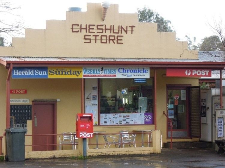
Cheshunt Post Office opened on 2 August 1886.
The Cheshunt post office now operates out of the general store/ takeaway food shop.
Golfers play at the course of the Whitfield and District Golf Club.
Following the closure of the small local primary school sometime in the 1970s-1980s, primary aged children must now travel to the Whitfield Primary school a short distance up the road.
Cheshunt also has a local public/ memorial hall and several wineries in the immediate area.
A popular local recreational and fishing area is Lake William Hovel further up the valley