
Founded February 25, 1889 Area 15,734 km² County seat Roswell | Website co.chaves.nm.us Population 65,823 (2013) | |
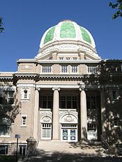 | ||
Colleges and Universities New Mexico Military Institute, Eastern New Mexico University-Roswell Campus Rivers Pecos River, Rio Peñasco, Berrendo Creek, Peñasco, Rio Points of interest Spring River Zoo & Park, Roswell Museum and Art C, International UFO Museum, The Anderson Museum, Spring River Park | ||
Chaves County is a county in the U.S. state of New Mexico. As of the 2010 census, the population was 65,645. Its county seat is Roswell. Chaves County was named for Colonel Jose Francisco Chaves, a military leader here during the U.S. Civil War and later in Navajo campaigns. Created by Territorial Legislature, February 25, 1889, out of land from the county of Lincoln.
Contents
- Map of Chaves County NM USA
- Geography
- Adjacent counties
- National protected areas
- 2000 census
- 2010 census
- Politics
- City
- Towns
- Census designated place
- Unincorporated communities
- References
Map of Chaves County, NM, USA
Chaves County comprises the Roswell, NM Micropolitan Statistical Area.
Geography
According to the U.S. Census Bureau, the county has a total area of 6,075 square miles (15,730 km2), of which 6,065 square miles (15,710 km2) is land and 9.8 square miles (25 km2) (0.2%) is water. It is the fourth-largest county in New Mexico by area.
Adjacent counties
National protected areas
2000 census
As of the census of 2000, there were 61,382 people, 22,561 households, and 16,085 families residing in the county. The population density was 10 people per square mile (4/km²). There were 25,647 housing units at an average density of 4 per square mile (2/km²). The racial makeup of the county was 71.95% White, 1.97% Black or African American, 1.13% Native American, 0.53% Asian, 0.06% Pacific Islander, 21.25% from other races, and 3.12% from two or more races. 43.83% of the population were Hispanic or Latino of any race.
There were 22,561 households out of which 35.60% had children under the age of 18 living with them, 52.70% were married couples living together, 13.70% had a female householder with no husband present, and 28.70% were non-families. 24.80% of all households were made up of individuals and 11.60% had someone living alone who was 65 years of age or older. The average household size was 2.66 and the average family size was 3.17.
In the county, the population was spread out with 29.10% under the age of 18, 9.40% from 18 to 24, 25.30% from 25 to 44, 21.50% from 45 to 64, and 14.70% who were 65 years of age or older. The median age was 35 years. For every 100 females there were 95.90 males. For every 100 females age 18 and over, there were 91.60 males.
The median income for a household in the county was $28,513, and the median income for a family was $32,532. Males had a median income of $26,896 versus $21,205 for females. The per capita income for the county was $14,990. About 17.60% of families and 21.30% of the population were below the poverty line, including 29.10% of those under age 18 and 13.90% of those age 65 or over.
2010 census
As of the 2010 United States Census, there were 65,645 people, 23,691 households, and 16,646 families residing in the county. The population density was 10.8 inhabitants per square mile (4.2/km2). There were 26,697 housing units at an average density of 4.4 per square mile (1.7/km2). The racial makeup of the county was 70.9% white, 2.0% black or African American, 1.2% American Indian, 0.6% Asian, 0.1% Pacific islander, 21.9% from other races, and 3.2% from two or more races. Those of Hispanic or Latino origin made up 52.0% of the population. In terms of ancestry, 10.1% were German, 9.3% were Irish, 8.5% were English, and 4.6% were American.
Of the 23,691 households, 37.7% had children under the age of 18 living with them, 48.9% were married couples living together, 14.9% had a female householder with no husband present, 29.7% were non-families, and 25.2% of all households were made up of individuals. The average household size was 2.70 and the average family size was 3.22. The median age was 34.7 years.
The median income for a household in the county was $37,524 and the median income for a family was $43,464. Males had a median income of $37,573 versus $26,250 for females. The per capita income for the county was $18,504. About 15.9% of families and 21.0% of the population were below the poverty line, including 27.1% of those under age 18 and 14.6% of those age 65 or over.
Politics
Chaves County is a Republican stronghold. No Democratic presidential candidate has won Chaves County since Lyndon Johnson's landslide victory of 1964. Even in that election, Johnson took Chaves County by only 1.3 percent.