
Country United States Largest city Charleston | State(s) West Virginia | |
 | ||
Other cities South Charleston
St. Albans
Dunbar | ||
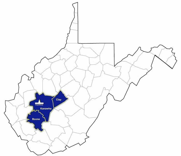
The Charleston Metropolitan Statistical Area, as defined by the United States Census Bureau, is an area consisting of three counties in West Virginia, anchored by the city of Charleston. It is the largest metropolitan area entirely within the state of West Virginia. While the Huntington Metro Area is more populous, it spans three states (West Virginia, Kentucky, and Ohio), and the core county of the Charleston area, Kanawha County, is more populous than the West Virginia portion of the Huntington area.
Contents
- Rankings
- Counties
- Places with more than 50000 inhabitants
- Places with 5000 to 15000 inhabitants
- Places with 1000 to 5000 inhabitants
- Places with less than 1000 inhabitants
- Demographics
- Interstates
- US Highways
- Appalachian Corridors
- Colleges and universities
- References
Charleston is its largest and most populous city in the MSA. Tornado is its largest census-designated place and Cross Lanes its most populous. As of the 2000 census, the MSA had a population of 309,635 (though new standards set on February 28, 2013 placed the population at 240,000). Prior to the 2000 Census, the Charleston MSA consisted of only two counties – Kanawha and Putnam (the latter of which is now considered part of the Huntington metropolitan area).
Rankings
The population of the Charleston MSA is ranked 151st out of the 363 MSA's.
Counties
In order of population:
Places with more than 50,000 inhabitants
Places with 5,000 to 15,000 inhabitants
Places with 1,000 to 5,000 inhabitants
Places with less than 1,000 inhabitants
Demographics
As of the census of 2000, there were 309,635 people, 129,229 households, and 88,175 families residing within the MSA. New definitions from February 28, 2013 placed the population at 363,000. The racial makeup of the MSA was 93.25% White, 4.66% African American, 0.21% Native American, 0.65% Asian, 0.02% Pacific Islander, 0.17% from other races, and 1.04% from two or more races. Hispanics or Latinos of any race were 0.55% of the population.
The median income for a household in the MSA was $29,222, and the median income for a family was $35,735. Males had a median income of $34,105 versus $20,448 for females. The per capita income for the MSA was $16,074.