
Country Kazakhstan Purpose Irrigation, power Opening date 1968 Height 28 m Impound Syr Darya | Location Shardara District Status Operational Type of dam Embankment, earth-fill Construction began 1964 | |
 | ||
Similar Moinak Hydro Power Pl, Schardara‑Talsperre, Ekibastuz GRES‑1, Bukhtarma Hydroelectric Power Pl, Ust‑Kamenogorsk Hydroelectric Power Pl | ||
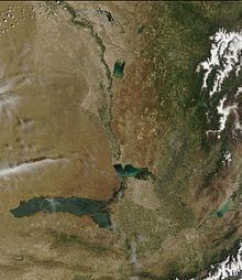
The Chardara Dam, also known as Chardarin Dam, is an earth-fill embankment dam on the Syr Darya River in Shardara District, Kazakhstan. It was constructed between 1964 and 1968 with the primary purpose of irrigation. The dam has an associated 100 MW hydroelectric plant named Shardarinsk Hydroelectric Power Station. The dam provides water to the Kyzyl-Kum channel for crop irrigation. The reservoir created by the dam has a maximum storage capacity of 5,700,000,000 m3 (4,600,000 acre·ft) and a surface area of 900 km2 (350 sq mi). The dam has been undergoing structural rehabilitation and a power station upgrade is currently in planning. The power station's four 25 MW Kaplan turbine-generators are scheduled to be upgraded to 31.5 MW each.
Map of Chardara Dam, Shardara, Kazakhstan
References
Chardara Dam Wikipedia(Text) CC BY-SA