
Sub-provincial city Xi'an Postal code 7101XX Area 1,583 km² Province Shaanxi | Time zone China Standard (UTC+8) 6 Yanta Population 1.083 million (2010) Local time Friday 3:50 AM | |
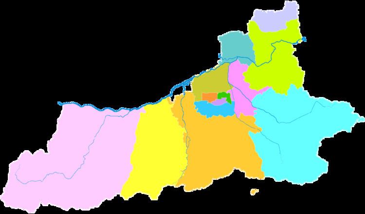 | ||
Country People's Republic of China Xi'an district map Subdivisions of Xi'an, Shaanxi
1
2
3
4
5
6
7
8
9
10
11
12
13
Districts
1
Xincheng
2
Beilin
3
Lianhu
4
Baqiao
5
Weiyang
6
Yanta
7
Yanliang
8
Lintong
9
Chang'an
13
Gaoling
Counties
10
Lantian
11
Zhouzhi
12
Hu Weather 3°C, Wind W at 3 km/h, 54% Humidity | ||
Chang'an District (simplified Chinese: 长安区; traditional Chinese: 長安區; pinyin: Cháng'ān Qū; literally: "long peace") is one of nine districts of Xi'an, the capital of Shaanxi province, China. It is the most spacious of the nine districts and third-largest out of all 13 county-level divisions of Xi'an, while it is also the second most-populous. The district borders the prefecture-level cities of Shangluo to the southeast and Ankang to the southwest, Weiyang and Yanta Districts to the north, Baqiao District to the northeast, Lantian County to the east, and Hu County to the west.
Map of Chang'an, Xi'an, Shaanxi, China
References
Chang'an District, Xi'an Wikipedia(Text) CC BY-SA