
Elevation 5,688 m | ||
 | ||
Similar Cerro Cañapa, Palpana, Umurata, Cerro Capurata, Tomasamil | ||
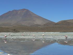
Cerro Araral is a mountain located in the Andes on the border between Chile and Bolivia in the Potosí Department and in the Antofagasta Region. It has a height of 5647 metres, rising over a base of 3900 metres and covers an area of 109.4 square kilometres (42.2 sq mi). The edifice has a volume of 43.4 cubic kilometres (10.4 cu mi), down from 47.2 cubic kilometres (11.3 cu mi) due to erosion. Based on the erosion rate, the volcano is 1.9 million years old. The modern snowline on the mountain lies at more than 5,700 metres (18,700 ft) altitude. The volcanism is at first andesitic and later becomes intermediary between andesite and basalt.
Map of Cerro Araral
References
Cerro Araral Wikipedia(Text) CC BY-SA