
Time zone EST (UTC-5) Area 10 km² | Elevation 85 m (279 ft) Area code(s) +53-7 | |
 | ||
Wards (Consejos Populares) Armada, Cerro, El Canal, Las Cañas, Latinoamericano, Palatino, Pilar-Atares | ||
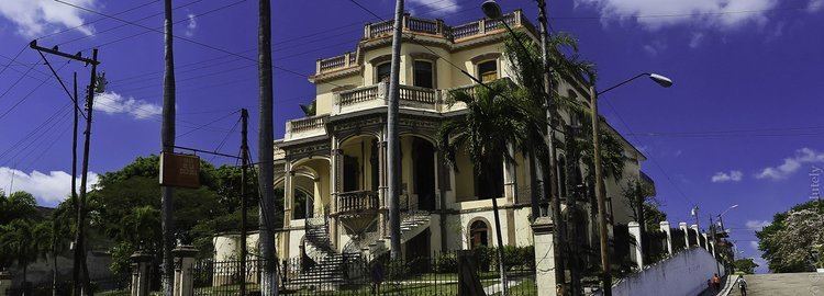
A walk in cerro havana near 20 de mayo boulevard near plaza de la revolution 1 of 2
Cerro is one of the 15 municipalities or boroughs (municipios in Spanish) in the city of Havana, Cuba. As of 2016 it is considered "one of Havana’s poorest municipalities."
Contents
- A walk in cerro havana near 20 de mayo boulevard near plaza de la revolution 1 of 2
- Map of El Cerro Cuba
- A walk in cerro havana near 20 de mayo boulevard near plaza de la revolution 2 of 2
- History
- References
Map of El Cerro, Cuba
A walk in cerro havana near 20 de mayo boulevard near plaza de la revolution 2 of 2
History
The area dates from 1803 when two property owners José María Rodríguez and Francisco Betancourt established residence. Their example was followed by many others. In 1807, Cerro was recognized as a town with the construction of the first wooden church, which has been replaced by the current parish buildings.
Cerro was chosen by wealthy families of the capital as a place to spend the summer. In 1843 there existed five large vacation residences, with 23 others notable for their sumptuousness. There were also 273 private homes owned by wealthy families. In 1800, Cerro's population was 2,000; 2,125 in 1843; and by 1858, there were 2,530 permanent residents.