
Founded 1896 Postal code 90001 Population 2,508 (2011) | Time zone UTC -3 Dial plan +598 433 (+5 digits) | |
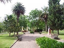 | ||
Cerrillos or Los Cerrillos is a very small city in the west part of the Canelones Department of southern Uruguay.
Contents
- Map of Los Cerrillos Canelones Department Uruguay
- Location
- History
- Population
- Places of worship
- References
Map of Los Cerrillos, Canelones Department, Uruguay
Cerrillos is also the name of the municipality to which the city belongs. It was created on 15 March 2010 by the Act of Ley Nº 18.653. It comprises the electoral districts CCA and CEB of Canelones department. The localities Campo Militar, Sofía Santos, Las Brujas and Parador Tajes are parts of this municipality.
Location
The city is located on the intersection of Route 36 with Route 46, about 16 kilometres (9.9 mi) southwest of the city of Canelones and 40 kilometres (25 mi) north west of the centre of Montevideo.
History
It was founded on 3 August 1896. On 5 July 1907, its status was elevated to "Pueblo" (village) by the Act of Ley N° 3.188, and on 23 October 1958 to "Villa" by the Act of Ley N° 12.581. Finally, on 20 July 1971, it received the status of "Ciudad" (city) by decree N° Ley 13.990.
Population
In 2011 Cerrillos had a population of 2,508. In 2010, the Intendencia de Canelones estimated a population of 7,369 for the municipality during the elections.
Source: Instituto Nacional de Estadística de Uruguay