
Country Burkina Faso Time zone GMT 0 (UTC+0) Clubs and Teams ASFA Yennenga | Capital Ouagadougou Area 2,805 km² | |
 | ||
Points of interest Parc Bangr Weogo, Ouagadougou Cathedral, National Museum of Music, Musée National Du Burkin, Faso Loisirs Colleges and Universities University of Ouagadougou, University Ouaga Ii, National School of Administr | ||
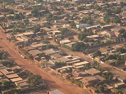
Centre is one of Burkina Faso's 13 administrative regions. The population of Centre was 1,523,980 in 2006 and increased by 40.2% in 5 years to 2,136,581 in 2011 (est.). It is the most populous and urbanised region in Burkina Faso; in 2006 11.1% of Burkina's population lived in Centre. The region's capital is Ouagadougou, which also serves as the national capital. Centre region consists of only one province, Kadiogo.
Contents
Map of Centre Region, Burkina Faso
As of 2010, the population of the region was 1,262,783 with 53.05 per cent females. The population in the region was 8.03 per cent of the total population of the country. The coverage of cereal need compared to the total production of the region was 17.00 per cent. As of 2007, the literacy rate in the region was 63 per cent, compared to a national average of 28.3 per cent.
Geography
Most of Burkino Faso is a wide plateau formed by riverine systems and is called falaise de Banfora. There are three major rivers, the Red Volta, Black Volta and White Volta, which cuts through different valleys. The climate is generally hot, with unreliable rains across different seasons. Gold and quartz are common minerals found across the country, while manganese deposits are also common. The dry season is usually from October to May and rains are common during the wet season from June to September. The soil texture is porous and hence the yield is also poor. The average elevation is around 200 m (660 ft) to 300 m (980 ft) above mean sea level. Among West African countries, Burkino Faso has the largest elephant population and the country is replete with game reserves. The northern regions are generally arid and usually have scrub land and semi-deserts. The principal river is the Red Volta, that originates in the northern region and drains into Ghana. The areas near the rivers usually have flies like tsete and similium, which are carriers of sleep sickness and river blindness. The average rainfall in the region is around 25 cm (9.8 in) compared to southern regions that receive only 100 cm (39 in) rainfall.
Demographics
As of 2010, the population of the region was 1,262,783 with 53.05 per cent females. The population in the region was 8.03 per cent of the total population of the country. The child mortality rate was 35, infant mortality rate was 47 and the mortality of children under five was 80. As of 2007, among the working population, there were 47.80 per cent employees, 14.50 per cent under employed, 31.60 per cent inactive people, 37.80 per cent not working and 6.20 unemployed people in the region.
Economy
As of 2007, the literacy rate in the region was 63 per cent, compared to a national average of 28.3 per cent. The gross primary enrollment was 84.8 per cent, pos-primary was 51.8 per cent and gross secondary school enrollment was 27.5. There were 8660 boys and 8781 girls enrolled in the primary and post-secondary level. There were 508 teachers in primary & post-secondary level, while there were 4969 teachers in post-primary and post-secondary level. Adult (15+) literacy in the region increased from 55% in 2003 to 63% in 2007. In 2011 the region had 869 primary schools and 354 secondary schools (25% of the national total). The University of Ouagadougou is also located in the region and had around 40,000 students in 2010 (83% of the national population of university students).
As of 2007, there were 162 km (101 mi) of highways, 134.6 km (83.6 mi) of regional roads and 7 km (4.3 mi) of county roads. The first set of car traffic was 5554, first set of two-wheeler traffic was 32,587 and the total classified road network was 304. The region is junction for many of the nation's roads and is the terminus of the only railway in the country. Ouagadougou International Airport is located in the region and as of June 2014 the airport had regularly scheduled flights to most major cities in West Africa as well as Paris, Brussels and Istanbul. The total corn produced during 2015 was 47,395 tonnes, cotton was 000 tonnes, cowpea was 14,060 tonnes, ground nut was 9,288 tonnes, millet was 15,712 tonnes, rice was 7,531 tonnes and sorghum was 29,971 tonnes. The coverage of cereal need compared to the total production of the region was 17.00 per cent.
Administrative Areas
Burkina Faso got independence from French Colonial Empire during 1960. It was originally called Upper Volta. There have been military coups till 1983 when Captain Thomas Sankara took control and implemented radical left wing policies. He was outsed by Blaise Compaore, who continued for 27 years till 2014, when a popular uprising ended his rule. As per Law No.40/98/AN in 1998, Burkina Faso adhered to decentralization to provide administrative and financial autonomy to local communities. There are 13 administrative regions, each governed by a Governor. The regions are subdivided into 45 provinces, which are further subdivided into 351 communes. The communes may be urban or rural and are interchangeable. There are other administrative entities like department and village. An urban commune has typically 10,000 people under it. If any commune is not able to get 75 per cent of its planned budget in revenues for 3 years, the autonomy is taken off. The communes are administered by elected Mayors. The communes are stipulated to develop economic, social and cultural values of its citizens. A commune has financial autonomy and can interact with other communes, government agencies or international entities.