
Population 331,007 (2015) (6th) Administrator Ian Reynolds Area 1,681 km² Region Central Coast | Time zone AEST (UTC+10) Website Central Coast Council Founded 12 May 2016 | |
 | ||
Established 12 May 2016 (2016-05-12) State electorate(s) Gosford
Swansea
Terrigal
The Entrance
Wyong Federal divisions Division of Dobell, Division of Robertson, Division of Shortland | ||
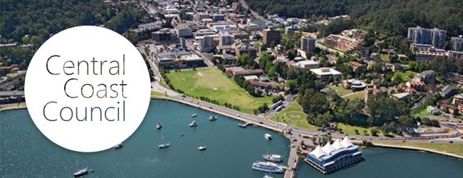
Central coast n s w australia in pictures
The Central Coast Council is a local government area serving the Central Coast region of New South Wales, Australia, established on 12 May 2016 following the amalgamation of Gosford City and Wyong Shire councils.
Contents
- Central coast n s w australia in pictures
- Central coast spearfishing vol 1
- Demographics
- Administration
- Wards
- Suburbs and localities
- References
The council comprises an area of 1,681 square kilometres (649 sq mi) and is bounded to the east by the Tasman Sea, to the south by Broken Bay and the Hawkesbury River, and to the west by the Yengo National Park northwards to Bucketty before heading eastward along George Downes Drive, encompassing the Olney State Forest and crossing the Pacific Motorway, meeting the southern edge of Lake Macquarie at Mannering Park and eventually reaching the coast north of Moonee. At the time of the council's establishment it had an estimated population of 331,007.
The Administrator of the Central Coast Council is Ian Reynolds, pending elections to be held on 9 September 2017.
Central coast spearfishing vol 1
Demographics
At the 2011 Census the former Gosford local government area had a population of 162,440; while the former Wyong local government area had a population of 149,746. This gave a nominal 2011 population of 312,186 for the Central Coast local government area; estimated as 331,007 in 2016 at the time of the council's establishment.
Administration
Pending the election to be held in September 2017, the local government area is administered by Ian Reynolds, with former Wyong Shire Acting General Manager Rob Noble appointed as Interim General Manager and Gosford City General Manager Paul Anderson appointed Deputy General Manager.
Wards
Will comprise fifteen Councillors elected proportionally in five wards with three Councillors elected in each ward. All Councillors are expected to be elected for a fixed four-year term of office with effect from 9 September 2017. The councillors will be elected to serve each of the following wards:
Suburbs and localities
The local government area includes a moderately densely populated coastal strip that extends northward from the Hawkesbury River and is bounded by the Pacific Motorway to the west, and an extensive sparsely-populated region to the west of the motorway that is largely native bush. The towns and villages located within Central Coast Council are: