
Local time Tuesday 4:59 AM | ||
 | ||
Weather 14°C, Wind S at 39 km/h, 68% Humidity | ||
Celeryville is a census-designated place on the boundary between the New Haven and Richmond Townships of Huron County, Ohio, United States. Celeryville is located approximately one mile south of Willard, and the community relies on Willard's social services.
Contents
Map of Celeryville, OH 44890, USA
Celeryville was originally settled chiefly by Dutch immigrants; the village was named for the celery farms near the original town site.
Geography
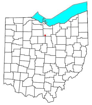
Celeryville is located at 41.029N, -82.731W. State Route 103 and Bullhead Road are the proprietary roads that bound and serve Celeryville.
Education
The Willard Area School District serves residents of Celeryville. The community is also the home of Celeryville Christian School, a pre-K-8 school.
Celeryville is a unique agricultural community. The soil of farmlands is muck. It is so rich that several years ago it caught fire. Farmers are able to grow vegetables much faster than other areas and can get one or two extra crops in a growing season. Ohio State University maintains an agricultural extension there. Migrant workers come yearly to tend and harvest the crops.