
NRHP Reference # 88000587 Added to NRHP 23 May 1988 | Area 10.83 km² | |
 | ||
Nearest city Westborough and Hopkinton, Massachusetts | ||
Cedar swamp archeological district top 7 facts
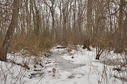
Cedar Swamp Archeological District is a historic district in eastern Westborough, Massachusetts, and extending into the northwest corner of Hopkinton. Cedar Swamp is an area of more than 1,600 acres (650 ha) of wetlands that include the headwaters area of the Sudbury River. Archeological surveys of the environmentally sensitive and critical area have identified Native American sites of interest. It is believed that Native Americans prized wood from the cedar trees that grew in the area.
One archaeological site of note is located on an island in the swamp, which was discovered in 1974 and excavated in 1984-86. Features of this site include a large refuse midden and a hearth, the latter of which has been radiocarbon dated to about 200 BCE. Neville and Stark projectile points were also found at this site. A second site of interest is based around a stone outcrop on the northern edge of the swamp. This site has extensive evidence of stone tool making, using materials gathered from the outcrop.
The archeological district, which encompasses much of the Cedar Swamp area, was added to the National Register of Historic Places in 1988.