
Website Catton Parish Council | Status Parish Local time Monday 11:00 PM | |
 | ||
Weather 4°C, Wind W at 8 km/h, 87% Humidity | ||
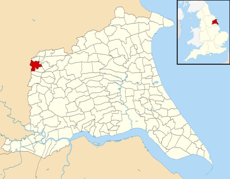
Catton is a civil parish in the East Riding of Yorkshire, England. It is situated 6 miles (10 km) to the north-west of the market town of Pocklington and covering an area of 1,232.568 hectares (3,045.74 acres). It lies on the east bank of the River Derwent that forms the boundary with the unitary authority of the City of York. The A1079 road crosses the river just north of Kexby Bridge which is designated a Grade II* listed building in and is now recorded in the National Heritage List for England, maintained by Historic England.
Map of Catton, UK
The civil parish is formed by the villages of High Catton and Low Catton. According to the 2011 UK census, Catton parish had a population of 348, an increase on the 2001 UK census figure of 284.
References
Catton, East Riding of Yorkshire Wikipedia(Text) CC BY-SA