
Country United States County Ottawa FIPS code 39-12588 Elevation 177 m Local time Monday 10:37 AM Area code 419 | State Ohio Time zone Eastern (EST) (UTC-5) GNIS feature ID 1086758 Zip code 43452 Population 3,157 (2000) | |
 | ||
Weather 14°C, Wind S at 21 km/h, 59% Humidity Area 43.77 km² (14.76 km² Land / 29.01 km² Water) | ||
Catawba Island Township is one of the twelve townships of Ottawa County, Ohio, United States. The 2000 census found 3,157 people in the township.
Contents
- Map of Catawba Island OH 43452 USA
- Communities
- Geography
- Name and history
- Government
- Tourism and Recreation
- References
Map of Catawba Island, OH 43452, USA
Communities
Geography
The township is located in the northeastern part of the county on the northern point of the Marblehead Peninsula, presently forming its own peninsula into Lake Erie — but formerly, it was an actual 'island'. It borders the following townships:
No municipalities are located in Catawba Island Township.
Name and history
It is the only Catawba Island Township statewide. The township's website claims that it was named for the variety of grapes that grew plentifully there, while another source claims that it is named for the Catawba tribe, who once lived in the Carolinas.
Although currently not an actual 'island', it is presently a peninsula; however, in prehistoric times, the Portage River is thought to have flowed into Lake Erie at the 'West Harbor' (near East Harbor State Park). This old channel of the river (which was also denoted on 19th-century maps) formerly made Catawba into an actual island; but all that currently remains of most of the old riverbed, is an insignificant ditch. Prior to about 1804, the British seem to have referred to this island as named 'Cunningham's Island' (but, shortly later, that name, "Cunningham's", seems to have been briefly transferred to present-day Kelley's Island, which had been named "Sandusky Island" in the 18th-century).
A large section of this township is within the Firelands region (the westernmost area of the Connecticut Western Reserve), and was originally a part of 'Danbury Township'.
Government
The township is governed by a three-member board of trustees, who are elected in November of odd-numbered years to a four-year term beginning on the following January 1. Two are elected in the year after the presidential election and one is elected in the year before it. There is also an elected township fiscal officer, who serves a four-year term beginning on April 1 of the year after the election, which is held in November of the year before the presidential election. Vacancies in the fiscal officership or on the board of trustees are filled by the remaining trustees.
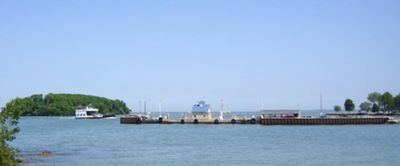
Tourism and Recreation
Catawba Island is a very popular summer destination. The long and protected shoreline provides multiple marinas and cottage communities. The Lake Erie Islands including the Bass Islands, Kelleys, and Pelee are all easily accessible. The Miller Ferry which is able to carry cars, trucks, and pedestrians to and from the islands operates off the tip of the peninsula.