
 | ||
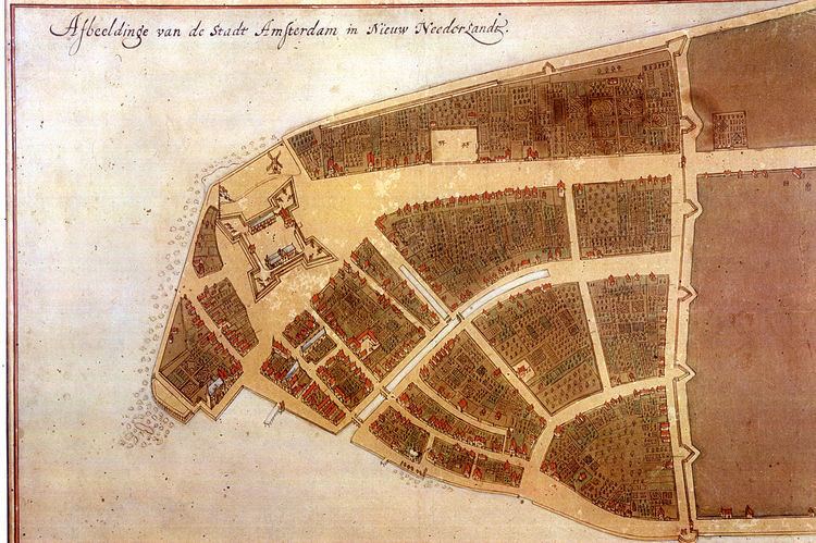
The Castello Plan — officially entitled Afbeeldinge van de Stadt Amsterdam in Nieuw Neederlandt (Dutch, "Picture of the City of Amsterdam in New Netherland") — is an early city map of Lower Manhattan from an original of 1660. It was created by Jacques Cortelyou (ca. 1625 - 1693), a surveyor in what was then called New Amsterdam — later renamed by Province of New York settlement as New York City. The map presently in the New York Public Library is a copy created around 1665 to 1670 by an unknown draughtsman from a lost Cortelyou original.
Around 1667, cartographer Joan Blaeu (1596–1673) bound the existing plan, together with other hand-crafted New Amsterdam depictions, to an atlas, which he sold to Cosimo III de' Medici, Grand Duke of Tuscany. This transaction most likely happened in Amsterdam, the Netherlands, as it has yet to be proven that Blaeu ever set foot in New Netherland.
The plan remained in Italy, where in 1900 it was discovered at the Villa di Castello near Florence. It was printed in 1916 and received the name "Castello Plan" at that time.
It is covered extensively in Volume 2 of Isaac Newton Phelps Stokes' six-volume survey, The Iconography of Manhattan Island (1915-1928).