
Country Brazil Population 149,918 (2010) Area 397.65 sq mi | State Para Region Northern Founded January 28, 1932 Mayor Paulo Titan (PMDB) | |
Castanhal is a city near the eastern edge of the state of Para northern Brazil. It is located some 65 km east of the state´s capital Belem and 50 km inland SE of the Bay of Marajo. It is accessed by car or bus via federal highway BR-316 . The climate is tropical rainforest. With a population around 185,000, it is the fifth largest city in the state.
Contents
Map of Castanhal, Para
coordinates: 1° 18? S, 47° 55? W
Os top do facebook de castanhalpa
History
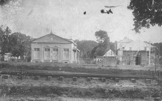
Castanhal was officially founded on January, 28th of 1932 (date of certification) and received its name due to the common nut trees (portug: Castanha) around the train station of the Braganca - Belem railway. Workers from the Brazilian Northeast started settling around the station. Local farmers started selling their products at the new market. Though, the new marketplace Castanhal was founded. The Braganca railway was shut down in 1964 and the rails were removed. The government of the state of Para gave Castanhal the nickname "cidade modelo" (Model Town). In 2004, Pope John Paul II erected the diocese of Castanhal, which is subordinated as a suffragan diocese to the archdiocese of Belem, Para.
Economy
Due to its convenient geographic location, Castanhal has become an important trading spot for food and agricultural products (cereals, corn, maniok, pepper, palm oil), affecting the entire Northeastern part of the state and beyond.