
Population 2,256 (2011 census) Postcode(s) 2168 Postal code 2168 | Established 1972 Founded 1972 | |
 | ||
Location 38 km (24 mi) south-west of Sydney | ||
Cartwright is a suburb in south-western Sydney, in the state of New South Wales, Australia 38 kilometres south-west of the Sydney central business district, in the local government area of the City of Liverpool.
Contents
Map of Cartwright NSW 2168, Australia
Geography
It is bounded by the suburbs of Prestons, Miller, Ashcroft, Sadlier, and Liverpool. Housing in the area is a combination of houses and flats. Cabramatta Creek forms the northern (Ashcroft/Sadlier) and west boundary (Miller), Maxwells Creek the east boundary (Liverpool), and Hoxton Park Rd the south boundary (Prestons). There is an extensive network of shared pathways interconnecting the many cul-de-sacs present in the area. A bridge also links it to Miller, crossing over Cabramatta Creek. Liverpool City BMX Club also has its grounds in Powell Park. There is also McGirr Park in the north-east.
History
Cartwright was officially declared a suburb in 1972 and was developed as part of the Green Valley Housing Estate in the 1960s. It was named after Robert Cartwright who was the reverend of St Luke's church in Liverpool and who received a land grant in the local area.
Education
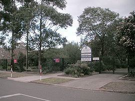
Cartwright Public school was opened in 1967. Macarthur Community College is also located within the schools grounds. The local high school is Miller Technology High School.
Transport
It is served by bus services T80 (Ash stop, not Cartwright), along the dedicated T-Way bus lane, and Busabout bus routes 861, 853, 854, 855. The nearest rail station is Liverpool, on the South Line. The main arterial road is Hoxton Park Road, leading to the Hume Highway in the east, connecting to Cowpasture Rd in the west. Cartwright Ave also feeds into smaller streets serving the rest of the suburb.
Demographics
According to the 2011 census, there were 2,256 residents in Cartwright. 55.7% of people were born in Australia. The most common other countries of birth were Vietnam 6.0%, Lebanon 3.0%, New Zealand 2.1%, Iraq 1.9% and Samoa 1.8%. In Cartwright 49.3% of people only spoke English at home. Other languages spoken at home included Arabic 9.9%, Vietnamese 9.8%, Samoan 3.5%, Spanish 2.3% and Hindi 1.8%. The most common responses for religion in Cartwright were Catholic 25.6%, Anglican 16.8%, Islam 13.3%, Buddhism 8.9% and No Religion 8.2%.