
Population 3,431 (2011 census) Postcode(s) 2163 Postal code 2163 | Established 1926 Founded 1926 | |
 | ||
Location 30 km (19 mi) west of Sydney CBD | ||
Carramar is a suburb of Sydney, in the state of New South Wales, Australia. Carramar is located 30 kilometres west of the Sydney central business district, in the local government area of the City of Fairfield and is part of the Greater Western Sydney region.
Contents
- Map of Carramar NSW 2163 Australia
- History
- Demographics
- Schools
- Notable people
- Commercial areas and transport
- References
Map of Carramar NSW 2163, Australia
History
Carramar's name comes from an aboriginal word meaning "shade of trees". The first land grant in the area was made by Governor King in 1803. When the railway station opened here in 1924 it was called South Fairfield. However, the area had been known as Carramar since at least the 1850s and the name of the station was changed to Carramar in 1926. A post office was opened the following year as the local population began to swell.
Demographics
According to the 2011 census of population, there were 3,431 residents in Carramar. 39.2% of people were born in Australia. The most common other countries of birth were Vietnam 13.0%, China 3.8%, Iraq 2.7%, Lebanon 2.1% and Fiji 1.7%. In Carramar 27.5% of people only spoke English at home. Other languages spoken at home included Vietnamese 17.2%, Arabic 9.3%, Cantonese 4.2%, Spanish 4.1% and Mandarin 3.4%. The most common responses for religion in Carramar were Catholic 25.6%, Buddhism 16.8%, Islam 12.3%, No Religion 9.0% and Anglican 6.9%.
Schools
Carramar Public School features an infants and primary school, although the school technically falls within the suburb of Villawood.
Notable people
Commercial areas and transport
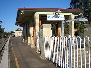
Carramar has a small commercial shopping centre, and a small industrial area. Carramar railway station is on the Bankstown Line of the Sydney Trains network.