
OS grid reference SN608832 Country Wales Postcode district SY23 Local time Wednesday 7:25 PM Dialling code 01970 Welsh assembly Ceredigion | Principal area Ceredigion Sovereign state United Kingdom Police Dyfed-Powys Community Y Faenor Ceremonial county Dyfed | |
 | ||
Weather 7°C, Wind S at 8 km/h, 92% Humidity | ||
Capel Dewi is a hamlet in Ceredigion, Wales, approximately 3.5 miles (5.6 km) east of Aberystwyth. It is one of two settlements called Capel Dewi in the county, the other being Capel Dewi near Llandysul.
Map of Capel Dewi, Aberystwyth, UK
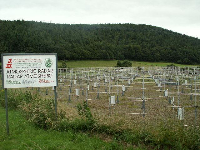
The majority of Capel Dewi lies south of the River Peithyll, a tributary of the Afon Clarach. One of the more unusual features of the hamlet is the nearby LIDAR system, which is run by the University of Manchester. In 2010 the LIDAR system at Capel Dewi provided vital information in the tracking of the ash cloud caused by the Icelandic volcano Eyjafjallajökull.
References
Capel Dewi, Aberystwyth Wikipedia(Text) CC BY-SA