
 | ||
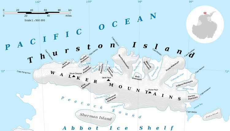
Cape Menzel (72°3′S 95°46′W) is a bold rock cape marking the northern extremity of the otherwise ice-covered Lofgren Peninsula, in the northeast part of Thurston Island, Antarctica. It lies southeast of Cape Braathen across Cadwalader Inlet. It was discovered on helicopter flights from the USS Burton Island and USS Glacier by personnel of the U.S. Navy Bellingshausen Sea Expedition in February 1960. The cape was named by the Advisory Committee on Antarctic Names for Reinhard W. Menzel, a geomagnetist-seismologist with the Eights Station winter party, 1965.
Maps
References
Cape Menzel Wikipedia(Text) CC BY-SA