Neha Patil (Editor)

Cape Davies

Updated on
Edit
Like
Comment
Share on FacebookTweet on TwitterShare on LinkedInShare on Reddit
Cape Davies

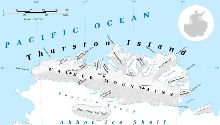
Cape Davies (71°50′S 100°4′W) is an ice-covered cape at the northeast end of the Hughes Peninsula, Thurston Island. It was first delineated from air photos taken by U.S. Navy Operation Highjump in December 1946, and was named by the Advisory Committee on Antarctic Names for Frank Davies, a physicist with the Byrd Antarctic Expedition in 1928–30.

Maps

  • Thurston Island – Jones Mountains. 1:500000 Antarctica Sketch Map. US Geological Survey, 1967.
  • Antarctic Digital Database (ADD). Scale 1:250000 topographic map of Antarctica. Scientific Committee on Antarctic Research (SCAR). Since 1993, regularly upgraded and updated.
  • References

    Cape Davies Wikipedia