
Time zone Central Time (UTC+6) Area 22 km² | Climate Cwb | |
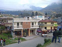 | ||
Cantel is a small municipality in the Quetzaltenango Department in Guatemala. It is located east of the city of Quetzaltenango and has an area of 22 km2. The village of Cantel is situated at 2,370 m altitude. The population is 32,221 people.
Map of Cantel, Guatemala
Cantel includes the small Maya archaeological sites of Chojolom and Cerro Quiac.
References
Cantel, Guatemala Wikipedia(Text) CC BY-SA