
Time zone CST (UTC-6) Elevation 399 m Population 1,415 (2000) | Established 1829 GNIS feature ID 69781 Local time Tuesday 11:01 PM Area code 479 | |
 | ||
Weather 7°C, Wind S at 6 km/h, 38% Humidity Area 90.39 km² (90.13 km² Land / 26 ha Water) | ||
Cane Hill Township is one of thirty-seven townships in Washington County, Arkansas, USA. As of the 2000 census, its unincorporated population was 1,415.
Contents
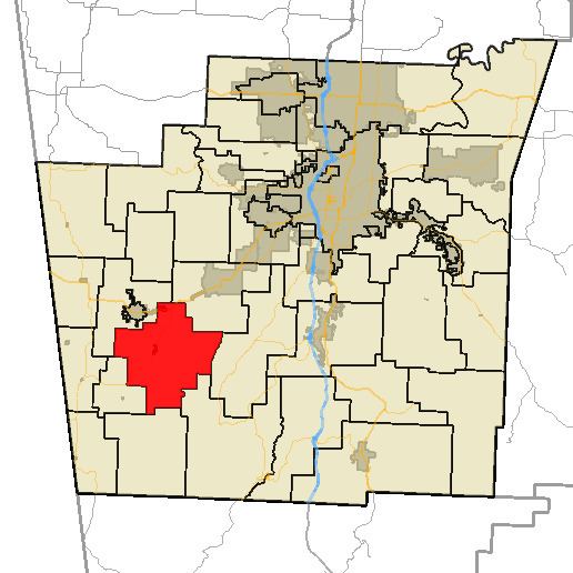
Map of Cane Hill Township, AR, USA
Geography
According to the United States Census Bureau, Cane Hill Township covers an area of 34.8 square miles (90 km2) of land and 0.1 square miles (0.26 km2) of water for 34.9 square miles (90 km2) in total area.
Cities, towns, villages
Cemeteries
The township contains eight cemeteries: Canehill, Cox, Kidd, McClellan, New Hope, Reese, Russell, and Yates.
Major routes
References
Cane Hill Township, Washington County, Arkansas Wikipedia(Text) CC BY-SA