Kalpana Kalpana (Editor)

Canal de l'Oise à l'Aisne

Updated on
Edit
Like
Comment
Share on FacebookTweet on TwitterShare on LinkedInShare on Reddit
Length
  
48 km (30 mi)

Start point
  
Abbécourt

End point
  
Bourg-et-Comin

Locks
  
13

Canal de l'Oise à l'Aisne httpsuploadwikimediaorgwikipediacommonsthu

Connects to
  
Canal latéral à l'Aisne at Abbécourt, Canal latéral à l'Oise at Bourg-et-Comin

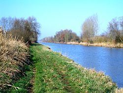
The Canal de l'Oise à l'Aisne is a summit level canal in northern France about 100 km NNE of Paris. It connects the Canal latéral à l'Aisne at Abbécourt to the Canal latéral à l'Oise at Bourg-et-Comin.

Contents

Map of Canal de l'Oise %C3%A0 l'Aisne, France

En route

  • PK 0 T-junction with Canal latéral à l'Aisne at Abbécourt,
  • PK 25.5 Pinon 49.48876°N 3.44885°E / 49.48876; 3.44885
  • PK 35 Pargny-Filain
  • Summit level reservoir 49.46856°N 3.55483°E / 49.46856; 3.55483 Bassin de Monampteuil
  • PK 38-40.5 Braye-en-Laonnois tunnel (2365m) 49.45619°N 3.58789°E / 49.45619; 3.58789 to 49.43816°N 3.60481°E / 49.43816; 3.60481
  • PK 48 T-junction with Canal latéral à l'Oise at Bourg-et-Comin
  • References

    Canal de l'Oise à l'Aisne Wikipedia