
Length 30 km Source elevation 436 m | Basin area 101.8 km² | |
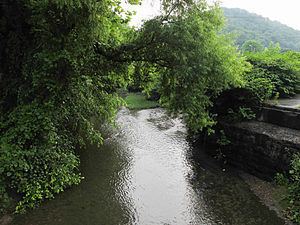 | ||
Campbells Creek is a tributary of the Kanawha River, 18.5 miles (29.8 km) long, in West Virginia in the United States. Via the Kanawha and Ohio rivers, it is part of the watershed of the Mississippi River, draining an area of 39.3 square miles (102 km2) on the unglaciated portion of the Allegheny Plateau, in the Charleston metropolitan area.
Map of Campbells Creek, Charleston, WV, USA
Campbells Creek flows for its entire length in Kanawha County. It rises approximately 0.4 miles (0.64 km) east of the unincorporated community of Putney and flows northwestward through Putney and the unincorporated communities of Annfred, Blount, Cinco, and Fivemile; then southwestward through the unincorporated communities of Tad and Coal Fork. It flows into the Kanawha River approximately 0.5 miles (0.80 km) north-northwest of Port Amherst. The creek is paralleled by county roads for most of its course.
The Geographic Names Information System lists "Campbell Creek," "Campbell's Creek," and "Nip-pi-pin-mah" as historical variant names for the creek.