
- elevation 6,287 ft (1,916 m) Basin area 2,618 km² Country United States of America | - elevation 4,783 ft (1,458 m) Mouth Mud Lake | |
 | ||
- location near Kilgore, Clark County, Idaho - location northeast of Mud Lake, Jefferson County, Idaho | ||
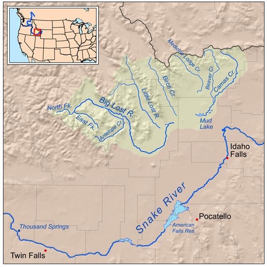
Camas Creek is a 63-mile (101 km) long tributary of Mud Lake in the U.S. state of Idaho. Beginning at an elevation of 6,287 feet (1,916 m) near Kilgore in northeastern Clark County, it flows southwest into Jefferson County and receives its largest tributary, Beaver Creek. It then passes through the Camas National Wildlife Refuge, and reaches its mouth northeast of the town of Mud Lake, at an elevation of 4,783 feet (1,458 m). Camas Creek has a 1,011-square-mile (2,618 km2) watershed.
Map of Camas Creek, Idaho, USA
References
Camas Creek (Mud Lake) Wikipedia(Text) CC BY-SA