
Majorjunctions Governors Drive | South end Whitesburg Drive Length 2.9 km | |
 | ||
North end Clinton Avenue(continues as Andrew Jackson Way) | ||
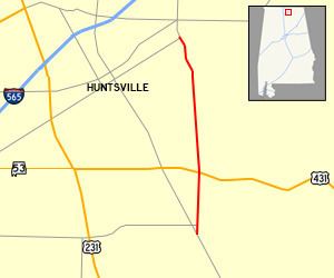
California Street is a major north-south thoroughfare in Huntsville, Alabama connecting historic Five Points to south Huntsville. On average, approximately 18,500 vehicles travel the 1.8 mile stretch of road a day.
Contents
Street Description
From the south, California Street branches off of Whitesburg Drive, headed north, immediately intersecting Bob Wallace Avenue. The five lane highway travels through a density populated residential neighborhood to meet Governors Drive (US-431) where it becomes the eastern boundary of the Huntsville Hospital medical district. California Street passes to the east of Huntsville High School and California Street Park. The road narrows to four lanes as it zig zags through another density populated residential neighborhood after passing Maple Hill Cemetery. The street takes on the name 'Andrew Jackson Way' at the intersection of Clinton Avenue where it continues to meet Holmes Avenue in Five Points and later connects directly to Interstate 565 at Oakwood Avenue.
History
California Street is one of the older streets in Huntsville, dating back to pre-Civil War.