
 | ||
The Cahill–Keyes projection is a polyhedral compromise map projection first proposed by Gene Keyes in 1975. The projection is a refinement of an earlier 1909 projection by Cahill. The projection was designed to achieve a number of desirable characteristics, namely symmetry of component maps (octants), scalability allowing the map to continue to work well even at high resolution, uniformity of geocells, metric-based joining edges, minimized distortion compared to a globe, and an easily understood orientation to enhance general usability and teachability.
Construction
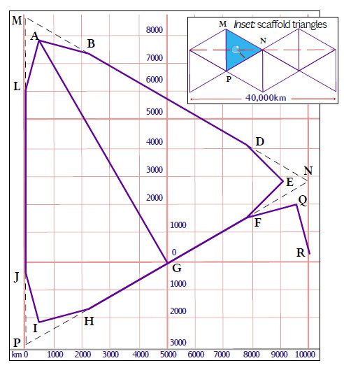
The Cahill–Keyes projection has 8 octants. The outer-edge width of those 8 octants is divided into 40,000 km, which approximates the Earth's circumference. Each octant is an equilateral triangle with three segments per side. The total length of each side is 10,000 km. One side runs along the equator. The inner meridians converge towards the pole. Each 1° and 5° "tile" are proportional to each other.