
 | ||
Rodeo in cadogan alberta canada
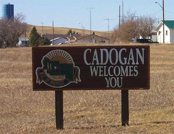
Cadogan is a hamlet in central Alberta, Canada within the Municipal District of Provost No. 52. Previously an incorporated municipality, Cadogan dissolved from village status on January 1, 1946 to become part of the Municipal District of Hillcrest No. 362.
Contents
Map of Cadogan, AB, Canada
Cadogan is located 9 kilometres (5.6 mi) south of Highway 13, approximately 110 kilometres (68 mi) southwest of Lloydminster.
Demographics
As a designated place in the 2016 Census of Population conducted by Statistics Canada, Cadogan recorded a population of 113 living in 47 of its 53 total private dwellings, a change of 6999900000000000000♠0.9% from its 2011 population of 112. With a land area of 0.64 km2 (0.25 sq mi), it had a population density of 176.6/km2 (457.3/sq mi) in 2016.
As a designated place in the 2011 Census, Cadogan had a population of 112 living in 43 of its 46 total dwellings, a -15.2% change from its 2006 population of 132. With a land area of 0.78 km2 (0.30 sq mi), it had a population density of 143.6/km2 (372/sq mi) in 2011.