
Topo map USGS Cache Peak Prominence 1,359 m Parent range Albion Mountains | Elevation 3,151 m Mountain range Albion Mountains | |
 | ||
Similar Mount Independence, Diamond Peak, Smoky Dome, Hyndman Peak, Ryan Peak | ||
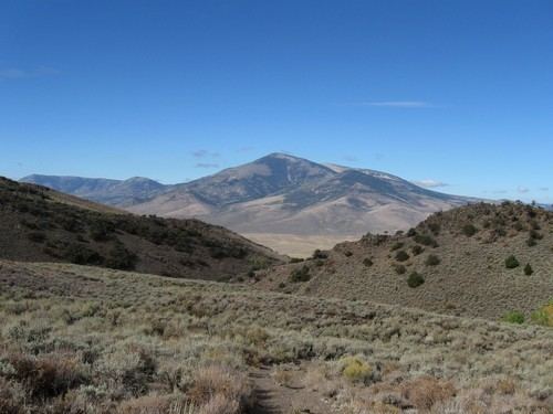
Cache Peak, at 10,339 feet (3,151 m) above sea level is the highest peak in the Albion Mountains of Cassia County in Southern Idaho. Cache Peak is located in the central part of the range southeast of Oakley and north of Almo in the Albion Division of the Minidoka Ranger District of Sawtooth National Forest.
Map of Cache Peak, Idaho 83342, USA
Cache Peak is in the watershed of tributaries of the Snake River, which itself is a tributary of the Columbia River. The peak is a part of the Great Basin Divide and the Basin and Range Province. It is the highest peak in Idaho south of the Snake River Plain, the highest in Cassia County, and north of City of Rocks National Reserve. The Independence Lakes are located in the basin north of the peak, and Mount Independence is about 1 mi (1.6 km) northwest of the peak. The peak can be reached via a non-technical hike, and there are several alpine lakes on the east side of the peak.
Cache Peak supports one of the three populations of Cymopterus davisii, a plant that is endemic to the Albion Mountains. The Cache Peak population is considered a single population with Mount Independence.