Last eruption 5050 BC ± 1000 years | Elevation 1,496 m Parent range Andes | |
 | ||
Similar El Negrillar, Cerro Overo, Cochiquito Volcanic Group, Caichinque, San Pedro de Tatara | ||
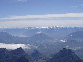
Caburgua-Huelemolle consists of four groups of cinder cones, namely they are Volcanes de Caburgua, Volcán Huelemolle, Volcán Redondo and Pichares. Volcanes de Caburgua is a group formed by six pyroclastic cones located at the southern tip of the Caburgua Lake, which is a lava-dammed lake created by volcanic activity from the just mentioned cones. Volcán Huelemolle is a group of three cinder cones lying between the rivers Liucura and Trancura.
Map of Caburgua-Huelemolle, Puc%C3%B3n, Araucania, Chile
References
Caburgua-Huelemolle Wikipedia(Text) CC BY-SA
