
Postcode(s) 2582 Postal code 2582 Lga Yass Valley Council | County Harden Elevation 574 m Local time Tuesday 8:14 PM Federal division Division of Hume | |
 | ||
Location 324 km (201 mi) from Sydney177 km (110 mi) from Wagga Wagga28 km (17 mi) from Bookham15 km (9 mi) from Woolgarlo Weather 18°C, Wind E at 19 km/h, 62% Humidity | ||
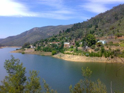
Burrinjuck is a village community in the far eastern part of the Riverina. It is situated by road, about 15 kilometres southwest from Woolgarlo and 28 kilometres south from Bookham. The name of the town is derived from an Aboriginal word meaning 'mountain with a rugged top'.
Map of Burrinjuck NSW 2582, Australia
The village is situated on the western side of Burrinjuck Dam which holds water from the Murrumbidgee River and which was constructed between 1907 and 1928 (with World War I interfering with the timing of the construction).
Barren Jack Post Office opened on 23 May 1907, was renamed Burrinjuck in 1911, and closed in 1979.
References
Burrinjuck, New South Wales Wikipedia(Text) CC BY-SA