
Country United States FIPS code 28-09820 Elevation 142 m Zip code 38833 Local time Tuesday 2:16 AM | Time zone Central (CST) (UTC-6) GNIS feature ID 0667827 Area 12.4 km² Population 934 (2013) Area code 662 | |
 | ||
Weather 17°C, Wind S at 23 km/h, 71% Humidity | ||
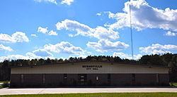
Burnsville mississippi antique car show
Burnsville is a town in Tishomingo County, Mississippi, United States. The population was 1,034 at the 2000 census.
Contents
- Burnsville mississippi antique car show
- Map of Burnsville MS 38833 USA
- Geography
- Rivers and streams
- Other formations
- Demographics
- Public schools
- Libraries
- Highways
- Railroads
- Media
- Notable person
- References
Map of Burnsville, MS 38833, USA
Geography
at 34°50′19″N 88°18′51″W (34.838564, -88.314098).According to the United States Census Bureau, the town has a total area of 4.8 square miles (12 km2), of which 4.8 square miles (12 km2) is land and 0.04 square miles (0.10 km2) (0.42%) is water.
Rivers and streams
Other formations
Demographics
As of the census of 2000, there were 1,034 people, 412 households, and 285 families residing in the town. The population density was 217.6 people per square mile (84.0/km2). There were 465 housing units at an average density of 97.8 per square mile (37.8/km2). The racial makeup of the town was 98.07% White, 0.39% Native American, and 1.55% from two or more races. Hispanic or Latino of any race were 1.26% of the population.
There were 412 households out of which 35.7% had children under the age of 18 living with them, 47.1% were married couples living together, 17.2% had a female householder with no husband present, and 30.6% were non-families. 29.1% of all households were made up of individuals and 10.7% had someone living alone who was 65 years of age or older. The average household size was 2.51 and the average family size was 3.06.
In the town, the population was spread out with 29.7% under the age of 18, 9.8% from 18 to 24, 27.1% from 25 to 44, 23.9% from 45 to 64, and 9.6% who were 65 years of age or older. The median age was 32 years. For every 100 females there were 87.3 males. For every 100 females age 18 and over, there were 82.7 males.
The median income for a household in the town was $20,083, and the median income for a family was $27,679. Males had a median income of $28,523 versus $18,333 for females. The per capita income for the town was $12,359. About 23.5% of families and 27.4% of the population were below the poverty line, including 34.8% of those under age 18 and 27.9% of those age 65 or over.