
Country United States County Porter Time zone CST (UTC-6) Elevation 186 m Local time Tuesday 1:56 AM Area code 219 | State Indiana FIPS code 18-09370 Zip code 46304 Population 1,411 (2013) | |
 | ||
Weather 17°C, Wind S at 39 km/h, 74% Humidity Area 17.59 km² (17.28 km² Land / 31 ha Water) | ||
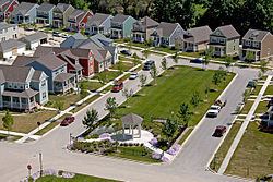
Burns Harbor is a town in Westchester Township, Porter County, Indiana, United States on the shores of Lake Michigan in Northwest Indiana. It is part of the Chicago metropolitan area. The population was 1,156 at the 2010 census. Burns Harbor is located adjacent to the Indiana Dunes, an area that conservationists have fought hard to preserve.
Contents
Map of Burns Harbor, IN, USA
Geography
Burns Harbor is located at 41°36′53″N 87°07′28″W (41.614685, -87.124560).
According to the 2010 census, Burns Harbor has a total area of 6.78 square miles (17.56 km2), of which 6.66 square miles (17.25 km2) (or 98.23%) is land and 0.12 square miles (0.31 km2) (or 1.77%) is water.
2010 census
As of the census of 2010, there were 1,156 people, 456 households, and 305 families residing in the town. The population density was 173.3 inhabitants per square mile (66.9/km2). There were 495 housing units at an average density of 74.2 per square mile (28.6/km2). The racial makeup of the town was 95.4% White, 1.8% African American, 0.3% Native American, 0.3% Asian, 1.1% from other races, and 1.1% from two or more races. Hispanic or Latino of any race were 5.8% of the population.
There were 456 households of which 37.3% had children under the age of 18 living with them, 51.5% were married couples living together, 10.3% had a female householder with no husband present, 5.0% had a male householder with no wife present, and 33.1% were non-families. 26.1% of all households were made up of individuals and 7.4% had someone living alone who was 65 years of age or older. The average household size was 2.54 and the average family size was 3.10.
The median age in the town was 34.6 years. 26.2% of residents were under the age of 18; 6.4% were between the ages of 18 and 24; 31% were from 25 to 44; 25.6% were from 45 to 64; and 10.6% were 65 years of age or older. The gender makeup of the town was 50.8% male and 49.2% female.
2000 census
As of the census of 2000, there were 766 people, 303 households, and 219 families residing in the town. The population density was 112.1 people per square mile (43.3/km²). There were 323 housing units at an average density of 47.3 per square mile (18.3/km²). The racial makeup of the town was 94.26% White, 0.26% African American, 1.17% Native American, 1.04% Asian, 0.39% from other races, and 2.87% from two or more races. Hispanic or Latino of any race were 4.31% of the population.
There were 303 households out of which 30.7% had children under the age of 18 living with them, 57.1% were married couples living together, 7.9% had a female householder with no husband present, and 27.4% were non-families. 22.8% of all households were made up of individuals and 7.3% had someone living alone who was 65 years of age or older. The average household size was 2.53 and the average family size was 2.95.
In the town, the population was spread out with 24.7% under the age of 18, 8.0% from 18 to 24, 28.5% from 25 to 44, 28.3% from 45 to 64, and 10.6% who were 65 years of age or older. The median age was 38 years. For every 100 females there were 103.7 males. For every 100 females age 18 and over, there were 111.4 males.
The median income for a household in the town was $53,929, and the median income for a family was $57,188. Males had a median income of $43,393 versus $22,143 for females. The per capita income for the town was $23,344. About 4.2% of families and 6.3% of the population were below the poverty line, including 5.4% of those under age 18 and 5.6% of those age 65 or over.
History
Burns Harbor was founded in 1966. The town took its name from a local port which was named for the harbor's promoter Randall W. Burns.
Transportation
Burns Harbor benefits from close access to many major forms of transportation.
Airports
Commuter Rail
Ports
Highways
Education
Burns Harbor is served by Duneland Schools (http://www.duneland.k12.in.us) providing education for grades Kindergarten through 12, and is in close proximity to many higher education facilities including: