
 | ||
The Burgberg (also called the Burgberge) is a ridge of hills up to 345.2 m above sea level (NN) high in the German federal state of Lower Saxony.
Contents
Map of Burgberg, 37640 Golmbach, Germany
GeographyEdit
The Burgberg, which belongs to the Solling-Vogler Nature Park, is located in the district of Holzminden in the Weser Uplands between the hill ranges of the Vogler to the north, the Homburgwald to the northeast, and the Solling to the south. It lies between the towns of Bevern in the southwest and Golmbach and Stadtoldendorf in the east. To the west flows the River Weser.
A section of the B 64 federal road runs along the southern part of the Burgberg, linking Holzminden with Negenborn.
SightsEdit
The ruined walls of the former castle of Everstein may be seen on the twin peaks of the Großer Everstein (345.2 m above NN) and Kleiner Everstein.
The tower of a former royal Prussian optical telegraph station, no. 28, part of the telegraph line from Berlin to Koblenz, can be seen on the central part of the ridge. Remains of the building foundations for the station have also survived. The tower is not open to the public. An information board describes the history of the optical telegraph.
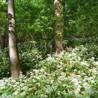
On the steep northern slopes of the Burgberg lies the Frauenschuhfläche ("Lady's Slipper Field"), a relic of the time when the slopes of the Burgberg were used to graze sheep and goats. The grazing of animals led to the creation of many areas of semi-dry grassland on which a specialised flora developed. These grasslands, with just a few sparse trees and juniper bushes, became favourite habitats for the Lady's slipper orchid, hence the field's name, as well as the fringed gentian, meadow clary and wild majoram. It has been placed under nature conservation and is accessible via a footpath. An information board describes how it was formed and the vegetation of the area.
HillsEdit
The hills of the Burgberg ridge include the:
Source: Topographische Karte 4123 der Niedersächsischen Landesvermessung und Kenntnisse als Revierleiter der Revierförsterei Burgberg
StreamsEdit
The streams on the Burgberg ridge include the: