
Population 2,540 (Ward. 2011) Sovereign state United Kingdom Local time Tuesday 12:19 AM | OS grid reference SK047728 Post town BUXTON | |
 | ||
Weather 3°C, Wind W at 14 km/h, 98% Humidity | ||
Burbage, is a village in Derbyshire, and was a parish until 1961, when it became part of the parish of Buxton. At the 2011 Census Burbage was a ward of the High Peak Council. The population taken at this Census was 2,540.
Map of Burbage, Buxton, UK
Burbage is well known for its Brass Band, the Burbage Band (Buxton).
Burbage backs onto Grinlow Woods and provides access to Solomon's Temple.
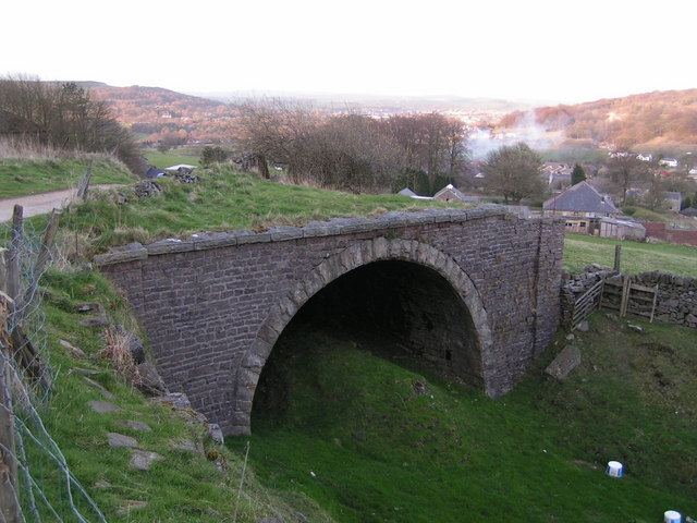
Burbage Tunnel is a remnant of the Cromford and High Peak Railway, which operated from 1831 to 1967, although the section near Burbage was abandoned in the 1890s in favour of a new alignment via Buxton.
Photographs of Burbage can be found at GENUKI
Burbage Golf Club (now defunct) first appeared in 1899. It continued until the 1920s.
References
Burbage, Derbyshire Wikipedia(Text) CC BY-SA