
Country Philippines Barangays ZIP code 6516 Local time Tuesday 8:17 AM | District 2nd district of Leyte Time zone PST (UTC+8) Area 265.3 km² Province Leyte | |
 | ||
Region Eastern Visayas (Region VIII) Weather 25°C, Wind N at 10 km/h, 88% Humidity | ||
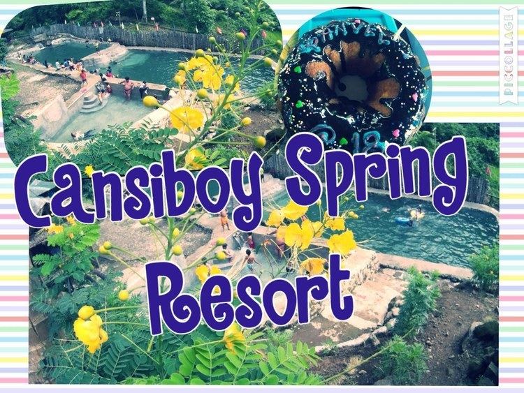
Burauen leyte philippines cansiboy spring resort ranvel at 18
Burauen is a 1st class municipality in the province of Leyte, Philippines. According to the 2015 census, it has a population of 52,732 people.
Contents
- Burauen leyte philippines cansiboy spring resort ranvel at 18
- Map of Burauen Leyte Philippines
- Places in burauen leyte wmv
- Etymology
- Barangays
- Economy
- Tourism
- Attractions
- Protection and Preservation
- References
Map of Burauen, Leyte, Philippines
It is located in the central part of Leyte Island, bounded to the north by Dagami and Tabon-tabon, on the east by Julita, south by Lapaz and on the west by Albuera and Ormoc.
Places in burauen leyte wmv
Etymology
The name "Burauen" evolved from the word “burabod” which means "spring". This is because Burauen is the fountainhead of several rivers: the big Daguitan and Marabong rivers, the Guinarona and Hibuga rivers that pass through several neighbouring towns, as well as several smaller ones. The legend behind the name speaks of a drought when several tributaries of these rivers dried up, forcing people to flock to a cluster of large springs in the town. The place was duly called “Buraburon” which according to Justice Norberto Lopez Romualdez Sr., is the “multiplicative construction of the word "haru” (spring), which indicates “abundance”. Over the years, the name “Buraburon” ("having many springs") evolved into “Burawon” and finally into “Burawen”.
Clandestine diggings conducted by antique hunters and verified by National Museum archaeologists yielded valuable artifacts consisting of chinaware and jars. Some of the discoveries were Stone Age artifacts and implements. These antiques and artifacts were found on the plateaus of both sides of the Kag-oloolo Brook of Barangay Patag and Villa Aurora, which were about 16 kilometers south-west of the poblacion of Burauen. Similar artifacts were found in Barangay Paghudlan which is 12 kilometers from the Kag-oloolo. Earlier diggings on the south-western portion of the poblacion, and those in Barangays Tambuco and Armasen, revealed several precious antiques. With the extensive presence of these artifacts over the said areas, the past locations of prehistoric settlements in Burauen during are indicated.
Barangays
Burauen is politically subdivided into 77 barangays.
Economy
Major economic activities of the people in this town include farming, trade/commerce and tourism. Palay, coconut and Abaca Fiber are among its major crops. With its existing wonders, Burauen recently on its way in developing its tourism industry. It is backed by good governance and improving quality of infrastructure development.
Tourism
Not known to others, Burauen has a lot to cater when it comes to beautiful and eye catching spots and sites. It is composed of vast wetland forest that houses thousands century old trees surrounding mahagnao volcano which is classified as an inactive volcano. Although, it has an active thermal activity.Also, there are two kinds of lakes. The one that on the southern foot of the volcano and the other one on the southeastern part.Hot springs, water fall and rivers are also the top destination famous on the area.
Attractions
Malagsum Lake This lake is smaller compared to the other one. But, it has an unique characteristics such as, being a highly acidic lake which contains high level of sulfuric acid making it impossible for marine lives or organisms to live. Except for the hundreds/thousands of migratory birds staying during migrating season Mahagnao Lake This lake serves as the main source of marine products for the locals and also the center of its tourism activities. Color Hot spring This hot spring is like a river of hot water colored with white and rocks which is look rusty and sometimes yellowish. Guin-aniban Water Fall The water fall is located few kilometers on the southeast. It is the water from the Mahagnao lake which is passing to systems of rivers then merge before approaching on the mouth of the cliff creating a water fall.
Protection and Preservation
Due to the fast development of tourism industry, locals are starting to contribute by joining local associations intended to took care of the natural park itself. With the support of several government agencies headed by the DENR Department of Environment and Natural Resources by giving funds and assistance to the local community for its several programs.