
Founded June 25, 1945 Postal code 5990 Elevation 138 m | Department Caazapá Time zone -4 Gmt Area 126 km² Local time Monday 1:57 AM | |
 | ||
Weather 24°C, Wind SE at 5 km/h, 91% Humidity | ||
Buena Vista is a city in Paraguay, Caazapa department; the beginning of this city was the result of the new political division of the country on June 25, 1945.
Contents
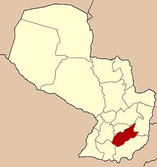
- Map of Buena Vista Paraguay
- Etymology
- Geography
- Weather
- Demography
- Economy
- Tourism
- How to get there
- References
Map of Buena Vista, Paraguay
Etymology
Its name describes the beautiful environment of the place.
Geography
Buena Vista is 266 km away from Asunción.
Weather
Temperatures range from 21°C to 37°C in summer, in winter the minimum is 1°C. This city is located in one of the regions with most precipitations, which is the reason why it is the best place for farming and cattle rising.
Demography
There is a total of 5.340 inhabitants, 2.773 are men and 2.567 women, according to Census 2002. In the urban area there are 1.416 people and the rural area, 3.924 people.
Economy
The main activity is farming and cattle rising.
Tourism
Wonderful landscapes which refer to the city's name "Buena Vista" (Good View) can be appreciated. Capiibary River is great for fishing.
How to get there
It is located 278 kilometres (173 mi) from Asunción, between San Juan Nepomuceno and Caazapá. From Asunción, take Route II "Mcal. José Félix Estigarribia" towards east. That route goes to Ciudad del Este.