
Length 10 km | ||
 | ||
Main source east of Nindorf71 m above sea level (NN) | ||
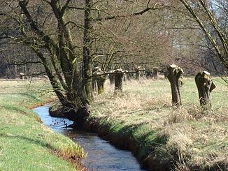
The Brunau is a 10.3-kilometre (6.4 mi) stream in the district of Celle, on the Lüneburg Heath in North Germany.
Contents
Map of Brunau, Bergen, Germany
Source and courseEdit
The Brunau rises in the vicinity of Nindorf, flows initially northeast to south of Hetendorf. Here it swings east, runs past Bonstorf to the north and then continues in a southeastern direction. North of the village of Baven the stream is dammed. Originally it powered a water mill here, the Backebergsmühle, a water-driven corn mill. The Brunau flows right under the building. Shortly before its mouth the Brunau merges with an old, now overgrown, meadow-irrigation channel. With this channel it discharges into the Örtze near Baven north of Hermannsburg.
Water qualityEdit
The Brunau derives its name from its brown (Low German: bruun) water. Its quality however is Class II throughout: moderately polluted