
Area code(s) 715 & 534 Elevation 337 m Local time Saturday 4:29 PM | Time zone Central (CST) (UTC-6) FIPS code 55-10500 Population 750 (2013) | |
 | ||
Weather 2°C, Wind SE at 24 km/h, 64% Humidity Area 6.19 km² (6.061 km² Land / 13 ha Water) | ||
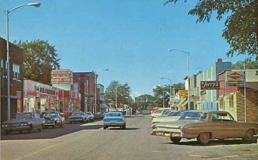
Bruce is a village in Rusk County, Wisconsin, United States. The population was 779 at the 2010 census.
Contents
Map of Bruce, WI 54819, USA
Geography
Bruce is located at 45°27′26″N 91°16′23″W (45.457203, -91.272923).
According to the United States Census Bureau, the village has a total area of 2.39 square miles (6.19 km2), of which 2.34 square miles (6.06 km2) is land and 0.05 square miles (0.13 km2) is water.
2010 census
As of the census of 2010, there were 779 people, 371 households, and 203 families residing in the village. The population density was 332.9 inhabitants per square mile (128.5/km2). There were 419 housing units at an average density of 179.1 per square mile (69.2/km2). The racial makeup of the village was 99.1% White and 0.9% from two or more races. Hispanic or Latino of any race were 1.0% of the population.
There were 371 households of which 26.1% had children under the age of 18 living with them, 38.5% were married couples living together, 11.9% had a female householder with no husband present, 4.3% had a male householder with no wife present, and 45.3% were non-families. 41.8% of all households were made up of individuals and 23.4% had someone living alone who was 65 years of age or older. The average household size was 2.10 and the average family size was 2.85.
The median age in the village was 45.9 years. 24.1% of residents were under the age of 18; 6.4% were between the ages of 18 and 24; 18.7% were from 25 to 44; 25.5% were from 45 to 64; and 25.4% were 65 years of age or older. The gender makeup of the village was 47.2% male and 52.8% female.
2000 census
As of the census of 2000, there were 787 people, 384 households, and 213 families residing in the village. The population density was 343.7 people per square mile (132.7/km²). There were 407 housing units at an average density of 177.8 per square mile (68.6/km²). The racial makeup of the village was 98.98% White, 0.25% Native American, 0.13% Asian, 0.25% from other races, and 0.38% from two or more races. Hispanic or Latino of any race were 0.25% of the population.
There were 384 households out of which 20.1% had children under the age of 18 living with them, 43.2% were married couples living together, 9.4% had a female householder with no husband present, and 44.5% were non-families. 41.1% of all households were made up of individuals and 24.7% had someone living alone who was 65 years of age or older. The average household size was 2.05 and the average family size was 2.73.
In the village, the population was spread out with 21.2% under the age of 18, 6.0% from 18 to 24, 22.0% from 25 to 44, 23.5% from 45 to 64, and 27.3% who were 65 years of age or older. The median age was 46 years. For every 100 females there were 85.6 males. For every 100 females age 18 and over, there were 81.3 males.
The median income for a household in the village was $26,250, and the median income for a family was $34,861. Males had a median income of $29,732 versus $20,917 for females. The per capita income for the village was $15,226. About 4.9% of families and 9.5% of the population were below the poverty line, including 7.0% of those under age 18 and 15.5% of those age 65 or over.