
Archipelago The Snares Width 0.5 km (0.31 mi) Population 0 | Length 1 km (0.6 mi) Highest elevation 86 m (282 ft) Elevation 86 m | |
 | ||
Island group Snares Islands / Tini Heke | ||
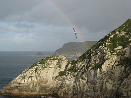
Broughton Island is the second largest island of The Snares, at 48°02′35″S 166°37′15″E just off the South Promontory of the main island North East Island, which lies approximately 200 kilometres (120 mi) south of New Zealand's South Island. The island is some 1 by 0.5 km (0.62 by 0.31 mi) long in SW direction, and the highest elevation is 86 m (282 ft). The island is named after William Robert Broughton.
Map of Broughton Island, New Zealand
References
Broughton Island, New Zealand Wikipedia(Text) CC BY-SA