
OS grid reference HU554649 Sovereign state United Kingdom Postcode district ZE2 Dialling code 01806 | Post town SHETLAND Lieutenancy area Shetland | |
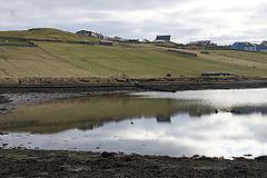 | ||
Brough is a settlement in western Whalsay in the parish of Nesting in the Shetland islands of Scotland. It lies to the southwest of Challister, northeast of New Park, and north of Tripwell. To the north is Kirk Ness, and Whalsay Parish Church.
Contents
Map of Brough, Shetland, UK
History
Historically, fishing has been the main source of income in Brough. There is a burnt mound in the south of the village and an old horizontal mill which first appeared on an 1882 map.
Cup marks
A feature here is a hillock with two groups of cup-marks at 60.366164°N 0.994392°W / 60.366164; -0.994392, believed to date to the Bronze Age. The upper group features 10 much-weathered cups, around 2 inches in diameter on average and as deep as an inch in an area of about 18 by 19 inches. The lower group features at least 19 weathered cups, measuring from between 2.5 and 3.5 inches in diameter and 1 to 2 inches deep, in an area of around 18 by 10 inches. There is an isolated cup, about 70 yards to the south.